Creation of the 3D Model from Interfaces
The basic input for creating a subsoil model is the master borehole and assigned interfaces in the table of layers.
The workflow for modeling is as follows:
In the Geological Sections frame, we create geological sections and:
- Define lines representing interfaces between layers
- Edit soil profiles
- Create interface points, which can be edited in the "Interface" frame.
In the Geological Model frame, we select the master borehole. We always select a borehole with the biggest number of interfaces (ideally all).
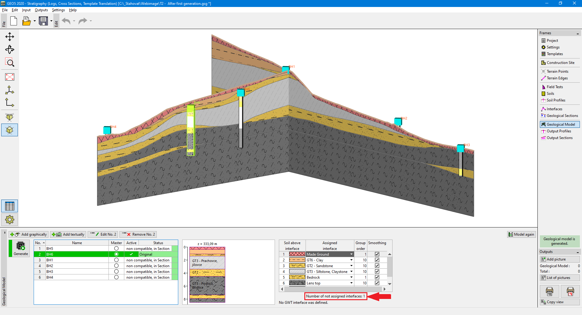
In the table of layers, we assign individual interfaces and define the order of layers generation. The interface represents a bottom border of the displayed soil. The continuous interfaces must be generated as first, then the other interfaces connected to continuous interfaces - e.g., soil lenses.
If not all defined interfaces are visible in the table of layers, it is necessary to edit master borehole and assign missing interface. The number of not assigned interfaces to the model is displayed below the table of layers. When all interfaces in the table are assigned, the information below the table is changed to "All interfaces are assigned".
 Model with one not assigned interface before edit of the master borehole
The layers with zero thickness are displayed on the visualization of a borehole.

After each model generation, it is appropriate to compare generated Output Sections of model with defined Geological Sections to check if the 3D model was created correctly.
The final model can be easily edited by adding new boreholes and changing their layers thicknesses.